
Run Bum may put on an epic race, but with the change from the marathon to the 50k, there was little known about the race course itself, other than the pictures posted and some scribbles on a map. Of course, this did not sit well with Ryan, so he used the maps to put together the course in mapmyrun so we could get an approximate elevation chart. I *knew* it was going to be hilly, remembered climbing the balds, but yup, that confirmed it. This was going to quite a race!
Race day dawned overcast and chilly. My dad graciously drove us out to the park in the dark at 5:15 am, winding up those old mountain roads, only to turn around and drive back down so that he could get some more sleep, oh and pack up the car and pick up my mom and Sam, and then drive back up again! Yes, we are so lucky! Thank you, Dad!
We arrived at the park around 6:00 am, the full moon shining above and a rather stiff, cold wind blowing. We situated our bags near the finish area, got ourselves ready, had time for a quick photo with Carolyn, who is working on an ultra in all 50 states!, and after a quick review of course directions, etc, we were off!

Sunrise below the clouds

Full moon

Cool bib!

TMR, ready to roll!

With Carolyn at the start
Of course, the start was 2+ miles back down the very steep paved road that ran up through the park to the start line at the visitor's center, which sat around 5,000 feet. This made for two very snappy first miles, which was a bit unsettling, but I tried to keep the pace as comfortable as I could and not get too worked up about it. After winding down a ways, we entered the woods on a wide old road which soon turned into twisty, rocky singletrack, running along some beautiful waterfalls.

Trail along the waterfalls.
(Not my photo. Taken off the FB page.)
I was in a rather slow moving conga line of runners at this point, and there was a bit more walking than I would have liked. At one of the switchbacks, the trail spread out a bit and I was able to weave my way around the train. Although I knew there was a lot of elevation to be had during this race and I wanted to pace myself to a certain degree, I didn't want to walk too much too early. I was trying to find the line between going too easy and pushing too hard. It was a bit of a fine line as I was uncertain of terrain and I had only a vague grasp of course and elevation overall.
We came out at Massie Gap, which I recognized from Friday's hike, and ran up the Rhododendron Trail. I was really glad we had gotten out on Friday for our hike and to see the ponies, as man, the weather had moved in and it was foggy, misty, rainy, windy moving up towards the AT - not ideal conditions.
A bit further along, we went through a gate at the edge of the park property and moved out onto US Forest Service land. The loop we were doing out there was supposedly replete with grand and sweeping views, but sadly, it was pea soup fog up there with whipping wind, and there was nothing to see. In fact, it was even hard to see the pink flagging, and at one point I was afraid I was going to be lost in the mist, coming to a junction out in the open with no idea where the next flag was. Luckily, several guys came upon me at that point and headed me in the right direction. I did do some hiking up here but as little as I could, as moving slowly meant getting cold. The trail was very wet up here with a lot of loose shale rock. Although it seemed like it should be runnable, it was a bit hard to get a rhythm with the loose, wet rock underfoot.

Misty, rocky trail
(Not my photo. Taken off the FB page.)
Coming back down from the Forest Service Loop, out of the mist
Eventually we headed back down off the ridge on an old road bed and into some lovely misty woods, and then down into heavier fog around mile 9 at the Scales, which was supposedly the first aid station. It was incredibly hard to see and there was a guy there directly us around the edge of the fencing, but no set up aid station. I wasn't too concerned as I had no need to stop and intended to eat mostly the gels in my pack, and to get water at the next aid station. However, come to find out, the Subaru never made it up the muddy, wet, rocky, slippery road, so there was no aid station. Yikes! Later, as we switchbacked along an old road, I caught up to a group of guys discussing aid stations. I told them I was sure we had passed the aid about 3 miles back and had about 3 to go until the next. This stretch was quite pretty, with a few views out into the valley, a few streams to cross and some longhorn cattle along the way.

Stream crossing
(Not my photo. Taken off the FB page.)

Longhorn cattle
(Not my photo. Taken off the FB page.)
I was feeling good, just plugging along, finding this stretch mostly runnable, which was nice. I did however, start to realize that I really needed a bathroom. I hoped I would find one at the next aid station! Thankfully, there was indeed a port-a-potty at mile 15 or so, along with well-stocked aid. I took a few minutes to go to the bathroom and fill up my bladder before heading off onto the next 8 mile out-and-back section.
The out-and-back included a big downhill from the aid station to a river crossing, probably 1+ miles steep down, on a very little used path, with lots of loose leaf matter and rocks. I had to hike some of it as I was just too uncomfortable running it. Then after the river crossing, the trail wound back up and around the hillside, finishing up with a mile long each way out and back on a road, way up and then way back down. There was, however, a beautiful stretch of rhododendron tunnels that we ran through before reaching the road - that was the highlight of those miles for sure. Also, since it was an out and back, it was a chance to see all the other runners. I ran into Ryan in the rhododendron on my way up and was happy to be able to tell he was running well! I saw Carolyn on the way down, looking good.

Rhododendron tunnel
(Not my photo. Taken off the FB page.)

Looking back down the road from near the turn-around point
(Not my photo. Taken off the FB page.)
I tried to run some of the road but it was a pretty steep grade, and I'd say I only managed to run 30% of it. There was an aid station at the turn-around and I stopped briefly to get a bit more water in my pack before heading back down. The return trip was pretty nice until I got to the bottom near the river crossing. Then it was a big a** haul uphill to the aid station at mile 24. The climb seemed relentless. I fell in with a guy for a stretch of it, and we chatted as we made our way slowly uphill.
I was still feeling pretty good, with no cramping, stomach issues or chafing, but the long stretches of hiking were making my quads and calves and butt hurt and making me realize I really should have gotten out on my hiking trips in preparation! Yikes! Finally, I reached the aid station again. Hurray! There was a bit of a flat stretch and it felt good to run and loosen up my legs, but it was short-lived, as we soon crossed the road and had a 1.5 mile climb back up to the visitor's center. I realize now that I got a bit complacent along this section, as I could and should have run a few more of the slighter grades, but I ended up mostly hiking along with everyone else in sight.
The forest floor here, protected by the wind, was awash in delicate spring beauty and was quite lovely. We wound our way up through the woods and finally saw the roof of the visitor's center. I saw Ryan, my parents and Sam, and headed on out for the final 1.6 mile loop around to the Twin Pinnacles, the highest point of the park. Mostly runnable, but still rocky and rooty and well, darn, I was tired ;) I tried my hardest to run "fast" but there was still some hiking/walking to be done. I looked at my watch and realized I was going to eke out an under 6 hour finish, but my watch only ended up reading 27.2 at the finish line :) A tough one for sure! Still, I was all smiles at the finish line. It was one heck of a race and definitely an adventure!

Finish line smiles and high five

Sam and Ryan

Happy runners
I ended up with a final time of 5:54:03 and 5th woman, and although I would have loved to have gotten a faster time, I know this was a course I didn't really train for in the sense of mimicking terrain and elevation so I feel good about how I held up throughout. I had a solid race overall and I'm happy with it. I am however, two days later, still nursing some seriously sore quads ;)
Ryan had an *awesome* race and came in 14th overall, with a time of 4:57! Seriously impressive! I am really proud of all the work he put in this winter to get race-ready and it showed on race day!
Carolyn was all smiles when I saw her hiking up the road near the turn-around at mile 20 and finished in a great 6:21. Yahoo!
51/149
5th woman
This was a really cool race, in a beautiful area, with wonderful volunteers, an energetic and enthusiastic race director who was out on course taking photos and at the finish line for high fives, and an overall great experience. I am really glad we were able to make this one happen! Despite the crazy weather up on the high ridges in those first miles, the weather truly was kind to us - it was cool and overcast; there were no sunburns or heat exhaustion; we didn't get drenched by rain, just refreshed by showers ;) And we didn't get blown off the mountain or hypothermic, so that's a plus too! Also the sun did end up coming out a bit near the end, which was nice!
No photos of the view we didn't see, but I can imagine the sweeping vistas.

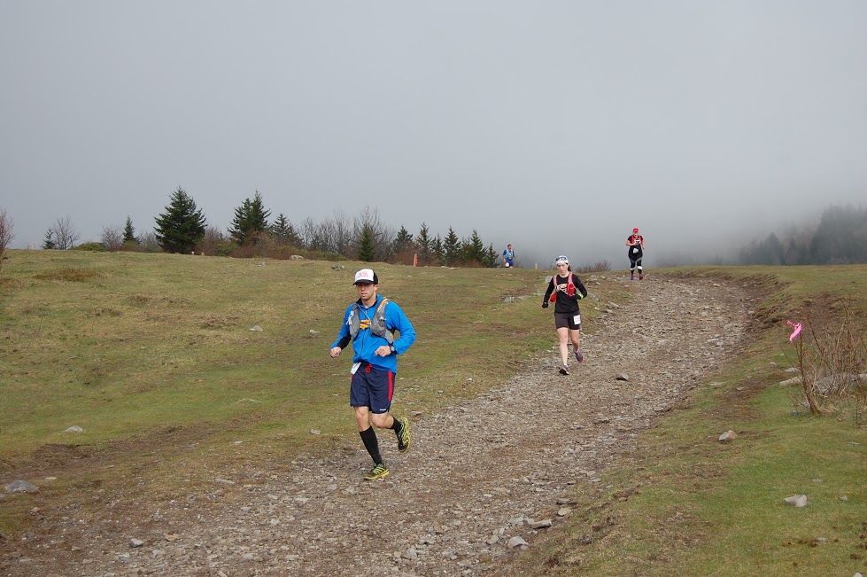
Along the course
(Not my photo. Taken off the FB page.)

Cool forest
(Not my photo. Taken off the FB page.)

Steep climb
(Not my photo. Taken off the FB page.)

My elevation profile from the race
(And yes, those first 2 miles were all downhill on pavement, and yes,
8:42 and 8:41 is a bit scary to see!)
Sam made us an awesome sign which she and my mom were holding up at the finish line. It included a "running words" section. *I love it!* And yes, pain and happy do indeed reside side by side... Why else would we run? :)

Running words: By Sam
P.S. I would be remiss if I didn't give a huge shout-out to my parents for helping us make this race happen. They happily shlepped us across the state, drove all over the place, my dad dropped us at the race before the sun came up and they watched Sam while we ran the race. Super grandparents! We are incredibly lucky and so happy to have had them with us! Thanks so much Mom and Dad!!!! We love you :)


3 comments:
Impressive races for you and Ryan despite challenging conditions. Big congrats!
It sounds like a great place to run, especially given the memories!
Great race report, D! I was looking forward to reading it!
Ann
Nice work by both of you. Did all finishers get a pony ride as a reward?
I must say I am not an experienced trail runner. This will be my 6th Ultra - ranging distances as some were loop courses. I just ran Boston and think that clouded my mind. I am a little nervous about this one.
Post a Comment