Tuesday, July 22, 2008

Snowman Says: On the AT - Caratunk to Monson

July 20, 2008 | Miles: 14.4
Start: Route 201, Caratunk
End: Bald Mountain Brook Campsite

After a great shuttle ride from Dana at Shaw's Lodging, we hit the trail at about 10:30 in Caratunk. At this point, I feel compelled to announce that I was not grouchy. Nor was I grouchy when we left the house at 6:15...well, maybe just a little. It was an uneventful morning, but it was muggy. The sun was out sporadically, which kept the temperatures down, but we were still soggy. Really soggy. We cruised through the first 6 miles, and stopped for lunch at Pleasant Pond Lean-To. I'm sure D will account the "hilarious" story of my inability to find the privy.

After lunch we had the climb up Pleasant Pond Mountain. It wasn't that pleasant. It was steep. Now I was grouchy. Normally, I'm all for a good climb, but I just didn't have it today. The worst part was the descent...or the lack there of. We had entered Time Warp Ridge. We just kept going along this ridge forever. We'd descend at bit, but just keep going. It was really annoying. It felt like we were moving but not getting any closer to our destination. Plus, I was feeling really sluggish. Not sure what was going on. Oh, and I was grouchy.

About 6 weeks later we finally hit the actual descent and navigated the almost ford-worthy crossing of Baker Stream. We set up camp at the Bald Mountain Brook Campsite and waited for the rain.

July 21, 2008 | Miles: 13.1
Start: Bald Mountain Brook Campsite
End: Stealth site near Horseshoe Canyon Lean-To

It poured last night. Once again our tent proved up to the task as we stayed nice and dry. However, nothing was really dry. Boots, clothes, everything. It was so humid yesterday and overnight nothing dried even a little bit. Here's a fun way to wake up in morning: put on a pair of wet underwear. Good times. (No, I don't bring extra underwear...too heavy.) Another fun way to wake up is to cross a stream to get to the privy. Expedition Poo was underway. Lucky, we didn't fall in...the stream or the privy. I saw a Magnolia Warbler near the privy. That was cool.

The day started with a climb up Moxie Bald Mountain. Nice climb: not too long, not too steep. Amazing views. I'd do this one again.

Today was a day of hanging out. We hung on the summit of Moxie Bald. We hung out at Moxie Bald Lean-To eating lunch on the shore of Bald Mountain Pond, which was also beautiful. We chatted with a lot of Southbounders. Lots of hanging out. All of this made for a slow day. We also had to river fords: Bald Mountain Stream and the West Branch Piscataquis River. The former was easy; not even knee deep. The latter was a little tricky. It was mid thigh deep on me. As many of you know, my hiking partner is...well, kinda short. She crossed in her underwear, since it was pretty high on her. She wouldn't let me take a picture.

After the second ford, we only had 3 miles to the shelter, but they seemed longer. Eventually, we just put up the tent at a great spot along the banks of the West Branch, which we followed ever since the ford. A long day, but a good one.

July 22, 2008 | Miles: 9.2
Start: Stealth site near Horseshoe Canyon Lean-To
End: Route 15, Monson

As it turns out we were only about .2 miles south of Horseshoe Canyon Lean-To last night, so that meant a shorter day today than we had expected. That's always a good thing.

What wasn't so good was our feet. Hamburger time. Putting your feet into wet boots for the third day in a row is not pleasant. D's heels. My little toes. Lots of redness, blisters, and general yuk. It lead to this exchange:

Me: "With every step I hear a faint, muffled f&*k you coming from my boots."
D: [singing] "F&*k you. F&*k you. La La La La La F&*k you."

Needless to say, nothing even remotely that hysterical happened for the rest of the day. In fact, this may be the funniest song she's ever sung while hiking. It's close to her epic "My Bum is Wet" song, which is too amazing to put into words.

Bolstered by that, we cruised today. It helped that the terrain was mellow, but we were moving pretty well. Even though we did have a ford of the East Branch Piscataquis River, we were at the car before 1:00. But, we were muddy. Mud was the overwhelming theme of these three days. 75% of the trail was mud. And 25% of the mud was boot sucking and soaking mud. It was messy. Really messy. The fords were great because they actually gave us a chance to clean off. Our feet are going to need a day or two to recover. That being said, it was a good trip. Mostly uneventful, but good.

On the AT - Caratunk to Monson

Photos here

July 20, 2008 | Miles: 14.4
Start: Caratunk
End: Bald Mountain Brook Campsite

We parked the car in the AT parking lot in Monson, and got a shuttle with Daina from Shaw's Lodging back to Caratunk. It was a nice drive, giving us a preview of the Kennebec. I can see why they have a ferry to shuttle hikers across the river! It looks more like a lake than a river. We finally got hiking around 10:30, a bit of a late start, but with the logistics of hiking point-to-point that just seems to be the norm. The first 6 miles to Pleasant Pond Lean-to went by rather quickly, and we stopped to have lunch. There we met Duck, who was hiking northbound. We ended up leap frogging with her throughout the rest of the day. From the lean-to, we climbed up to Pleasant Pond Mountain, and spent what seemed like an endless amount of time wandering along the ridgeline. It was really really humid and we were soaked. Snowman was getting cranky. Finally we got down off the ridge, and enjoyed some yummy blueberries along a powerline crossing before pushing through the final miles to a nice campsite along Bald Mountain Brook. We set up and managed to eat dinner, get organized and into the tent for the night before it started to rain.

Flora and fauna notes: Lots of bunchberries, looking gorgeous with their red berries; blue beads, milk weed, queen anne's lace, Indian pipe, a few juncos, sparrows and chickadees.

July 21, 2008 | Miles: 13.1
Start: Bald Mountain Brook Campsite
End: Stealth site along the river before Horseshoe Canyon Lean-to

It rained pretty hard overnight, and turned the trail into a mud pit and/or stream. Still, we enjoyed a nice climb up Moxie Bald Mountain, passing through some really pretty mossy old pine forest on the way up. The summit area had been burned at some point in the past, and the rock ledges were open, with views off into the distance. It was a nice spot to stop, have a snack and let the tent fly dry out a bit. The trail wandered along the summit, taking us through lots of sheep laurel and blueberry bushes, as well as a lot of mud pits.

From there, we descended to Bald Mountain Pond, where we stopped for an early lunch along the shore, enjoyed the tranquil lake. Saw two loons out on the water. Neat! The trail after the pond looked "flat" on the elevation profile of the map, but it was very slippery, muddy, and wet. We also had to ford the West Branch Piscataquis River, for which I actually removed my skirt and was glad I did. The water came up to the top of my thighs! Snowman was nice enough to not photograph me as I crossed the river :-) After all the fording, mud and wet trail, my feet were taking a beating. My heels were killing me in the last few miles to our campsite. Not to mention that although the trail followed the river, it actually went up and down and up and down along the banks, sapping my remaining energy. Still, the river was beautiful and we ended up at a nice campsite about 0.2 miles before Horseshoe Canyon Lean-to, right by the river, listening to the water roaring by.

Flora and fauna notes: The highlight today was the pair of loons we saw on Bald Mountain Pond! Also saw a hummingbird when we stopped at our campsite! Neat. Also several toads, frogs, 2 snakes. More blueberries! Yum.

July 22, 2008 | Miles: 9.2
Start: Stealth site along the river before Horseshoe Canyon Lean-to
End: Monson

More rain during the night, but we awoke to clearing skies. Snowman was actually up before I was, and we were on the trail by 7:30, which is pretty early for us. We stopped at Horseshoe Canyon Lean-to so Snowman could use the privy and I could put moleskin on my heels. They were, as Snowman said, looking like "hamburger." Ugh! And ouch! We were laughing that we could hear a chorus of our feet whispering "f*** you" along with the roar of the river beside us. In fact, I came up with a nice little song about it :-) The moleskin helped, but only lasted until our ford of the East Branch Piscataquis River 2.7 miles later. The map's description had hyped up this ford, but in fact it was the mellowest ford of the whole trip, with the river looking quite mellow and pretty, lined with milk weed and Canada lilies. Gorgeous! A friendly northbounder gave me some Blister Blocks and moleskin for my heels, and this helped quite a bit, but eventually wore off... Oh well. After the river crossing, we climbed and meandered, the trail crisscrossing some snowmobile trails and taking us through more mud holes. Still, we were moving right along, making good time, enjoying the relatively mellow terrain. Wandered the shores of another lake, Lake Hebron. We ate an early lunch on Buck Hill, and then booked it to the road, finishing up before 12:30. After a quick rinse in the pond just 0.1 down the trail and a change of clothes, we were on our way home. Overall, a solid three days. I could have used to be a bit less wet overall, as my legs and feet, along with other select parts, were less than happy to be soaked for so long. But, there were some nice stretches of trail and it was fun to run into so many southbound thru-hikers along the way. We wish them luck with their trail adventures!

Friday, July 18, 2008

Early Bird Run

5:45am. And I was running.

Now, I am a morning person, but seriously, this might be a little too early. I know people get their runs in this early all the time, but I am not quite used to getting out of bed at 5:05 so that I can be running by 5:45. But you do what you have to do, and I needed to be in the car and on the way to work by 8:00, and wanted to get in 8 miles. Hence, the early start time. Snowman says I'm nuts. I say I'm training.

The mist was rising over the fields as I headed out Pleasant Hill Road, and the birds were chirping. Traffic was light. It was actually quite pleasant. And I felt good, which was nice. I finished in 1:10, and according to mapmyrun.com, the route was a bit over 8 miles. Perfect. Today's miles brought the week's total to 31, including yesterday's 5 miles through the Commons. A decent mileage week for me, which I'm pretty happy with.

I think after today's run, I'm going to sign us up for the MDI Marathon. Why waste getting up so d*** early for an 8 mile run if it isn't in pursuit of some endurance event?!

Tuesday, July 15, 2008

3 with the Deer flies

Went across the street for a quick 3-mile run this morning before work. Overall, I was feeling a bit tired, but my legs felt surprisingly good after our 15-miler yesterday. I'll take it!

The downside of the run was that the deer flies were everywhere. Buzzing, biting, landing. Ugh. Perhaps it was due to the fact that I was wearing a bright blue hat and blue shirt... Jamie has been doing some deer fly research and discovered they are attracted to bright blue. I'll have to remember that! I may just have to try Jamie's trick of the "blue-cup hat" if he can prove in further experimentation that it works :-) This could be the newest running gear trend!

Monday, July 14, 2008

Foggy 15

Snowman and I headed out at 8am for an early morning 15 mile run. Why 15 miles? Well, we are contemplating running the MDI Marathon in October. I say contemplating because well, everyone knows that Snowman is prone to injury, so we haven't signed up yet. We have, however, made hotel reservations at the hotel at the start line. We have until August 1 to make our decision, as that is when the entry fees go up, not to mention there is a limited field. So, we are on our own self-made marathon plan and are taking this month to see if we think we'll be up for the run. MDI is known as scenic but difficult, so we want to be prepared. Of course, in our typical Sparkplug and Snowman fashion of cramming as much in as possible, we are also trying to finish up our final 250-odd miles on the AT this summer. So, we have a busy next few months ahead of us. I think we can train pretty solidly for the marathon while also doing a fair amount of hiking, but there will certainly be a bit of juggling going on, as well as what will likely be some tiring weeks.

So, back to this morning's run... Snowman was none to happy to be up and out so early, as expected. But we had plans to head over to Raymond to have lunch with my grandmother, so the run had to get done early in order to get done at all.

It was another foggy morning as we headed out from the field house. We went out through the Commons and into the Pennellville neighborhood. I've said it before, but this is a great area of Brunswick. The colors of the purple loosestrife, wild roses, buttercups and other flowers were really popping against the grey backdrop of the low fog, and we saw some great birds along the fields. 4 turkeys, 1 Snowy Egret, red-winged blackbirds, multiple male Goldfinch, lots of sparrows, a few Barn Swallows, and the highlight: a BobWhite! We heard him call and as I was saying, "was that a Bobwhite?" there he was along the side of the road. As we drew parallel to him, he ran along the shoulder next to us, too dumb or terrified to realize he'd be better of turning left and heading into the brush if he wanted to escape us. Very cool.

The route took us along several more of the back roads down to Maquoit Bay, where we were able to see a bit of the ocean through the clouds. We then headed to Pleasant Hill Road and back to Maine Street. However, instead of heading left and running the 1 mile back to the field house, we went right and ran the 1.5 miles back to where we had exited the Commons. Although I was carrying, and had been drinking, my bottles of HEED and HammerGel, my energy was starting to wane at this point. Not to mention that turning off the pavement, where there is no real need to focus on footing, back onto the sand/dirt for the last few miles made me feel like I was working a bit more. Not that this is a bad thing - in fact it's probably good training! I was a bit cranky at the very end, as Snowman pushed the pace a bit in the last mile or so, and I would probably have been just as happy to slow down a bit :-) But again, good training.

The skies opened up for a quick soaking just as we were running through the last Bowdoin fields, but it felt good. We were already soaked with sweat, so a bit more water didn't hurt!

Despite feeling a bit tired in the last few miles, it was a great run, and good to know that we can crank out 15 miles without too much trouble at this time in the summer. According to Snowman's calculations on mapmyrun.com, the route was 15.01 miles, so we were right on, and finished in 2:13:00.

After a quick shower and homemade breakfast sandwich, we headed to Wild Oats to pick up some sandwiches and dessert for lunch with Mim. Yum! A good treat after a good run :-)

Sunday, July 13, 2008

Lunch with Kris and Andy

...and Tina, Greg, baby Gannon and now-toddler Aidan! Not to mention Snowman :-)

We had a great afternoon in Portsmouth with two of my best friends. It was great to see everyone :-)


Saturday, July 12, 2008

Evening Run

I got in a nice mellow 3 mile run on Friday to stretch the legs out after my Highland Road run on Thursday. The legs were a bit tired, but I think it was good to get the blood flowing.

My intentions were to follow up this 3 mile run with a 5-miler this morning. That didn't quite happen. I guess I was pretty tired, and instead of jumping out of bed when the alarm went off, I promptly went back to sleep. Have to say, it felt pretty good :-) Of course, then I raced around trying to get things done before heading up to work, so it wasn't a totally relaxing morning. I knew Snowman might be home late, as they had a big event going on at the Road, so I decided I would bring my running stuff and try to motivate to run on the way home from work.

I am notorious for my inability to get in a run in the evening. Much like Snowman and his aversion to morning runs. But I was determined to get in my 25 miles this week, and that meant doing 5 today. Things took a turn for the better when Snowman called around 4:15 saying he was on his way. He wanted to do a night run, but I convinced him we might be just as happy to meet up at 6:30 for a run before dinner. So, we rendezvoused at the field house, and headed out into the quiet fields for our run. The air was cool and the woods were quiet. Perfect night for a run! And a nice way to catch up after a few days apart.

And so finishes a pretty solid week of training, with two days of hiking and four days/25 miles of running. Now back to my ice cream :-)

Thursday, July 10, 2008

Highland Run

The alarm went off at 5:30am but I was already awake. Ronnie the cat seems to have become my new alarm clock, and he had decided that 5:20am was a good time to lick my face in a bid for attention. I got up, had a few bites to eat, stretched, got my fuel belt filled with 2 bottles (one of HEED and one with a raspberry Hammer Gel and water mixture), and headed out the door.

I started the run at 6:20am. It was incredibly foggy out. Nothing I was wearing was truly reflective, so I was glad for the sidewalk along Maine Street and the wide paved shoulder along Pleasant Hill Road. The fog stayed with me all the way up to the turn on to Highland Road, approx 40 minutes into the run. It was low and dense, and obscured most everything. But I know from experience that the run out Pleasant Hill Road is a beautiful one, with rolling fields and plenty of hills too! Along with the fog, it felt like it was about 99.9% humidity. Ugh.

The sky began to brighten as I meandered along Highland Road. Although it's only a few mils out of town, it feels like you are truly out in the country along this road. The road is lined with farms, big old rambling houses and the requisite fields, full of wild roses, milkweed, queen anne's lace, buttercups, morning glories and others. The fields were also alive with birds. I saw several red-winged blackbirds, 2 grey catbirds, three Bobolinks, five Barn Swallows, eastern starlings, grackle, sparrows, crows and chickadees.

As Snowman noted from his run on this route yesterday, there is really nothing flat about this loop. At the end of Highland is one big, steep uphill before the turn onto Bunganuc. I slowed down to a bit of a crawl here, but was able to pick it up again as I headed on Bunganuc toward Maquoit Bay. As I headed down towards the ocean, the fog obscured the landscape once again, and I could not see the beautiful vista out into the bay. I am often running in the opposite direction on this road, and there is always a nice mellow downhill towards the water. Of course, today, it was uphill. I was feeling tired and I was sweating. A lot. More gulps of HEED and Hammer Gel.

I plodded along, knowing that once I got to the high school, I was in the home stretch. My legs were getting a bit stiff, and the last mile back to the field house was a slow one. Still, finished the 11.75 mile loop (according to mapmyrun.com) in 1:43, which seems respectable. The road running is much harder on the legs, but I certainly can move faster on the pavement than out on the trails!

Anyway, this was one good workout along a beautiful route, and a great way to start the day!

Coincidentally, Snowman, who would not tell me his time for his run yesterday, finished his run of this same route in 1:44. Guess we've run enough together to keep up the same pace, even apart! :-)

Wednesday, July 9, 2008

Snowman Rises

Snowman headed out the door about 15 minutes ago for a 12 mile run. (I couldn't go with him due to work commitments, so I'll be doing the same run tomorrow morning, which is too bad, as it would have been more fun to do the run together.) As Snowman is known to be very cranky early in the morning, I'm really impressed he got up and out the door, especially as we seem to have lost power briefly during the night and the alarm didn't go off as planned. Now I just have to hope he doesn't decide to just curl up on the side of the road for a nap while he's out there :-)

Tuesday, July 8, 2008

Five Plus Blueberries in the Commons

They were calling for "unhealthy air" today. Doesn't that just make you think that as humans we're doing something seriously wrong to the world around us? Yikes! Needless to say, it was hot and humid and around 70 degrees when I headed out at 7am for a run in the Commons.

They're constructing a new hockey arena next to the Bowdoin field house, and they've already blocked off a lot of access to the fields. But this morning, even the narrow strip of gravel between the field house and the construction zone was blocked off. Crap! Around I went. The long way. Tack on another 1/4 mile to the out-and-back.

My legs felt pretty good, considering we'd spent the last two days backpacking. Of course, neither of those days were marathon hikes, but still solid days out in the woods. The downside of the run was the deer flies, which buzzed around continually, and the fact that the grasses towards the end of the Commons have started to get pretty tall and make the path really narrow. Nothing like high grass to make my legs itchy! Silly allergies...

But, the flies and grass were forgotten when I realized that the blueberries were starting to ripen! There is one stretch that gets great sun, out in the pine barrens, and the blueberries were everywhere along the trail. I couldn't resist stopping to pick a few :-) A nice refreshing boost mid-run!

Snowman Says: On the AT, Rt. 27 to East Flagstaff Rd.

July 6, 2008 | Miles: 8.0
Start: Rt. 27, Stratton
End: Avery Campsite

I hate, hate, hate getting up early. My body just doesn't respond. It's not pretty. So, I started off the day before six really, really cranky. As I slowly wake up, I become more human and palatable. By the time we drove the 2.25 hours to the trailhead, I was ready to go. We drove to the end of the hike to leave our car for the end of the trip and met Sue from the Stratton Motel who had agreed to give us a ride to the beginning of the hike on Route 27.

We started hiking just after 9:30 and things were fairly uneventful. We had a steady 2800' or so climb on the menu for the morning, but it was fairly easy. Sure, we were sweaty and working, but what else would you expect. We stopped for lunch at Horns Pond Shelter and ate on the shore of its namesake. One of the many camp/kid groups we would see on this trip had stop at the Pond for a swim and while they more than altered the tranquil setting, they certainly provided entertainment. Picture 14 year-old boys swimming and you get the idea.

After lunch, we climbed some more and took the side trail to North Horn. Great views and well worth it. The main trail goes over South Horn, which also provides great views. Needless to say, great rewards for the morning's climb. The trail descended from South Horn, meandered along the ridge and eventually climbed West Peak. (None of the peaks have Bigelow in their name, the ridge itself is just called Bigelow Mountain.) Once again, terrific views from what would be the high point of this trip, 4145'. Above treeline, the wildflowers were all in bloom: mountain azalea, labrador tea, diapensia and others. Good stuff.

We descended West Peak to Avery Memorial Campsite and set up shop for the night. It was only 3:30 and we could have continued a few miles to another campsite, but for some reason it never really occurred to us. Besides, the setting was pretty nice at 3800'. The water situation wasn't so nice, as D had to squeeze in between two rocks in order to pump the water. I took a shift, but it was tricky since I'm not 4'6". The real issue with the campsite was the bugs. The black flies were among the worst I have seen, and we spent as much time as possible hiding in the tent. Luckily, the temperatures were relatively cool, so we didn't sweat to death. We also had to eat dinner in the tent. We had Backpackers' Pantry meals: Wild West Chili with Beans. Let's just say that being trapped in the tent after Wild West Chili with Beans is potentially life threatening.

At about 8:00 we were finally able to be outside to "get some fresh air" without getting eaten alive thanks to cooler temps, and we headed north on the AT on the side of Avery Peak to watch the sunset. It was gorgeous, and we show you if we hadn't forgotten the camera. By 9:00 we were in the tent and sleeping thanks to the earplugs I found in my pack...we were sharing the campsite with another group of 10 teenage boys.

July 7, 2008 | Miles: 8.7
Start: Avery Campsite
End: East Flagstaff Rd.

Teenage boys don't get up early. In fact, when we left camp at 7:30, there still wasn't any movement from their tents. The temps had dropped overnight and we had a cool and breezy ascent to Avery Peak, which was beautiful first thing in the morning. Despite the gusty winds, we hung out on top for a while, and I took about 4,000 pictures before we started our descent. Since most of yesterday was up, most of today was down. What was up from yesterday were the heat and humidity. Not unbearable, like our death hike in the Mahoosucs, but definitely noticeable. I noticed because I was completely drenched with sweat.

Eventually, we reached Safford Notch for a snack break at around 9:15. We didn't stay long as the mosquitoes had replaced the black flies as the blood sucking machines of the day. BTW, do not purchase Cutter Skinsations insect repellant. It's gross. The smell is just awful. It smelled worse that I did. Oh, and it doesn't really work. Other than that, it's a great product.

After our break we began the meandering climb to the ridge of Little Bigelow Mountain. It was only about 1,000 feet up and fairly mellow, but less than an hour after our snack break I had to stop. I totally bonked. It was strange. I sat on a log, ate a couple fig newtons and pumpkin seeds, and then we started again. I guess I had expended all the "fuel" from the Wild West Chili with Beans.

We wandered along the top of Little Bigelow for about 3 decades. It went on forever...and ever...and ever. Eventually, we reached the "summit." which is really the north end of the ridge. (Based on my altimeter, I'm pretty sure it's not even the high point.) We stopped here for lunch. We could look back at the entire length of hike, which was a great way to wrap up the trip.

It was all downhill from here, as we dropped of the ridge towards Flagstaff Lake, which was ever-present in the views both days, and our car. We stopped briefly at Little Bigelow Shelter for water and a privy break, but cruised for the most part. After passing a group of 15 or so French teenage girls, who laughed at my skirt...um, kilt, we reached the car at about 1:30.

We headed up the road to Round Barn Campsite to cool off in Flagstaff Lake before hitting the road for the 2.5 hours home. All in all, a great trip. Mellow, great views, good times. Definitely a place we'll get back to...well, once this whole AT thing is done. Just a couple more trips left this summer.

Monday, July 7, 2008

On the AT - Rt. 27 to East Flagstaff Rd.

Photos:
Page #1
Page #2

July 6, 2008 | Miles: 8.0
Start: Rt. 27, Stratton
End: Avery Campsite


The day started with a 2-hour drive in the fog, but by the time Sue from Stratton Motel met us at East Flagstaff Road for our shuttle to Rt. 27, the skies had cleared and it looked like it was going to be a beautiful day. We hit the trail at 9:30 and enjoyed the first few miles of nice, mellow woodland walking. Snowman was a bit grumpy, as he doesn't like that we're always up early for these adventures and the bugs were biting him, and I told him I was happy to continue on and finish up our remaining AT miles without him. He then reminded me that I don't know how to use our stove (which is, sadly, true) so we had a good laugh and got back into the swing of things :-)

This was a great section of trail. Very scenic. A few hours into the hike, we descended to Horns Pond for lunch. This pretty glacial tairn seemed to be the perfect tranquil spot for lunch, until a group of teenage boys came down to jump in the water and laugh and tell dirty jokes. Actually, it was quite entertaining!

From Horns Pond, we hiked up over the Horns, taking the side trail out to North Horn, with beautiful views of Sugarloaf in one direction and Flagstaff Lake in the other. The ridge meandered along, taking us over West Peak, which is in the alpine zone and has some of the same wonderful alpine flowers found around Mt. Washington and the Presidentials. Gorgeous!

From there, we descended into the col and arrived at Avery Campsite around 3:30. Not a super fast hike, but a good one. We chose what looked like the best tent platform and went to get water. There was not much, and the pool was in between two big rock slabs. I had to work my way up onto a ledge to sit and pump the water. Awkward, but it worked. The campsite appeared a bit forgotten and overgrown, but it was a decent spot, except for all the bugs! The black flies were relentless. We had to set up the tent fast and get into it to hide! It made for a bit of a long afternoon but we rested and looked at the maps and schemed for our upcoming trips. After dinner, we decided to walk a ways up the trail to see if we could see the sunset. We didn't have to go too far up the side of Avery Peak to get a beautiful view of the sun setting over Flagstaff Lake. It looked like a sunset you'd see in a poster. Brilliant orange and pinks. A great end to a nice day!

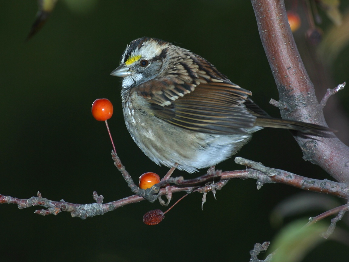
Flora and fauna report: There was common wood sorrel everywhere! Also a wonderful alpine display up on West Peak and Avery Peak - mountain azalea, labrador tea, diapensia. Also saw sheep laurel, bunchberry, blue bead lily, goldthread. On the fauna side of things, the toads were abundant, with lots of tiny ones the size of my thumb nail hopping about, as were the birds. Saw a number of juncos, chickadees, a Yellow-Rumped Warbler and a White Throated Sparrow, while Snowman saw a Black and White Warbler. Nice!

July 7, 2008 | Miles: 8.7
Start: Avery Campsite
End: East Flagstaff Rd.

We were up and out of camp at 7:30am, making the summit of Avery around 8am. A gorgeous morning with a brisk wind and wonderful light. We soaked up the views from Avery, and I couldn't help but think that times like this are why I like to hike. Gorgeous views. Good company. A nice brisk wind. Alpine flowers. What more could you ask for? From Avery we descended into Safford Notch, where the trail wandered alongside some very large erratics. Neat. The trail then took us up onto the ridgeline of Little Bigelow. There were some nice views from various outlooks and rock ledges, and we enjoyed lunch at the far end of the ridge, with views looking back at the whole Bigelow range. The day was heating up, and it was getting pretty warm as we descended to East Flagstaff Road. Luckily the descent was pretty quick and mellower than expected. We took a water break at Little Bigelow Lean-to and then boogied through the remaining mile. We hit the road at 1:30, and drove up to Round Barn to stick our feet in Flagstaff Lake and wash off a bit. The water was a bit too cold for me to do much more than that, but it felt good!

This was a great weekend of hiking. Beautiful terrain and much more manageable heat-wise than our trip around the GooseEyes. I've been wanting to hike the Bigelows since seeing them from the chairlift on Sugarloaf 8 or 9 years ago, and they did not disappoint!

Friday, July 4, 2008

10 on the 4th

I know it's supposed to be 4 on the 4th, but why not do more?

After a restless night, with Snowman arriving home around midnight and Ronnie the cat waking me up at 3:30, 5:30, 6:00, 6:30 and 7:30, we had a leisurely breakfast at Broadway Deli this morning. Strawberry and blueberry pancakes with one egg scrambled on the side ("I don't want to get into a semantic argument, I just want the protein") for me. Yum. Then we headed to Bradbury for a nice 10 mile run. The parking lot wasn't full, but there were a fair number of people out enjoying the nice day. The humidity seemed to have died down during the night (finally!), and it was quite pleasant out. Perfect for a run. We headed up the Northern Loop Trail to do one lap of the Bradbury Breaker course. As Snowman noted while we were running along, there are a fair number of ups and downs on this course and the second lap is likely going to be fairly brutal. Still, it was good to get one more round in on the course to get a feel for it. There were lots of walkers out on the trails, and we got a few good looks as we ran by. Yup, we were those "crazy runner types" :-)

After a quick stop to use the bathrooms and grab our extra fuel bottles when we finally looped back to the parking lot at 49 minutes, we headed across the street to do a lap on the Scuffle course. These trails tend to be lesser used, except by the mountain bikers who love the constant twists and turns of the single track. Over there, you get the feeling you're way out in the middle of nowhere as you weave through the woods. We ran into a foursome of bikers along the trail in the middle of the run but that was about it. I felt pretty good for most of the run, but was happy to reach the Snowmobile Trail and know we had only a mile or so back to the parking lot. To keep the run at 10 miles, we cut off the end of the Scuffle course and headed back in on the Link Trail.

This is a nice wide trail, and we were surprised to see the same foursome of bikers near the end of the trail along with one of the ranger's souped-up ATV/golf cart. One of the guys, who looked like a pretty competent biker, had tried to navigate over a rock on this flat stretch and went over the handlebars. His arm was in a make-shift splint. Poor guy. We helped one of the women walk his bike back to the parking lot, and she mentioned that he was probably trying not to do a shoulder roll as he had broken his collar bone in a road bike accident a few years ago. Man, I think I'll stick with running! I'd like to keep up my streak of no broken bones!

Total run time: 1:48:38. And now it's time to relax. Happy 4th of July everyone!

Thursday, July 3, 2008

A few more miles...

Another mellow run this morning. Our regular 3-mile loop in the Commons is getting a bit overgrown, but there were no bugs, which was nice. I felt good, and am looking forward to a good 10-miler at Bradbury with Snowman tomorrow. An extra day off - hurray! :-)

Tuesday, July 1, 2008

Mellow Start to the Week

Got out the door yesterday for a quick 3-miler on the powerlines. It was super humid, and my legs were feeling a bit heavy from the race on Saturday. Still, it was nice to get out and loosen things up a bit.

I had contemplated doing a longer run this morning, but just didn't quite feel it when I got up, so decided to just take it easy and went across the street for 4 miles. For a change of pace, I went up and over the Mt. Ararat hill and down the back way into Highland Green. From there I went across onto the dirt road out toward the Cathance River Preserve trails, turned around and headed back home. I am definitely looking forward to getting out on the Preserve trails soon. Perhaps during one of my longer runs next week.

Flora and fauna report: The pink mountain laurel (or perhaps it is sheep laurel) are blooming along the powerlines. Very pretty. Also saw the mallard and towhee yesterday again, as well as many sparrows and robins. Not to mention the deer flies! The woods are definitely alive at this time of year.